
Imagine waking up to the sound of moving water and watching the evening light settle over the Dolores River. If that picture draws you in, you are not alone. River living near the Town of Dolores offers views, fishing, and a slower pace, but it also comes with unique rules and due diligence. In this guide, you will learn how flows work, what regulations apply, how to check flood risk, and what to verify before you buy. Let’s dive in.
Dolores River 101
Flows shaped by McPhee Reservoir
The Dolores River that runs through town is not driven only by snowmelt. Releases from McPhee Reservoir upstream influence seasonal flows for irrigation, municipal supply, and project purposes. That means fishing and boating conditions can change with reservoir operations. To understand timing and variability, review the Bureau of Reclamation’s context on McPhee operations and releases in the Dolores Project here.
Check the USGS gage before you go
Streamflows are monitored at the USGS Dolores gage (site 09166500). You can see realtime discharge, historical peaks, and station elevation. This helps you judge seasonal recreation, compare property elevations, and research flood history. Explore the gage data on the USGS site.
Access varies along the corridor
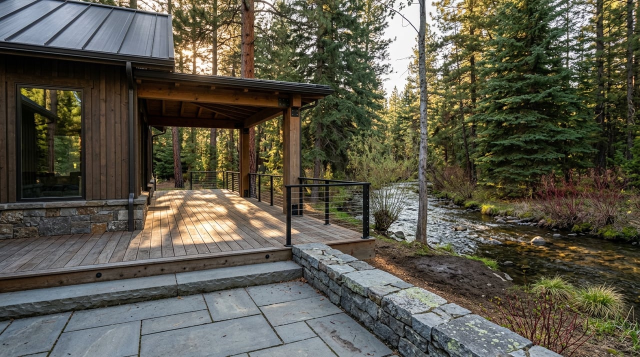
River frontage near Dolores includes a mix of private parcels, county lands, and public lands managed by federal agencies. Public access points can be limited in spots. If easy access is important, verify recorded easements and nearby public entry points as part of your contract due diligence.
Why people choose river living
Fishing, scenery, and a quieter pace
Below McPhee Dam, the Dolores is known for a technical trout tailwater fishery when flows allow. Colorado Parks and Wildlife highlights the river’s angling appeal and flow dependence in its Dolores River overview. Add in boating and time on nearby McPhee Reservoir, and you get a lifestyle that feels dialed to the seasons.
Typical properties and utilities
In-town parcels tend to be smaller and go through the Town of Dolores permitting process. Rural parcels in the valley often feature cabins, ranch-style homes, and larger acreage. Many rural homes rely on private wells and on-site wastewater systems, while some in-town homes connect to municipal water and sewer. If you are eyeing a remodel or new build inside town limits, start with the Town of Dolores Building Department to understand permit steps.
Rules, risks, and permits to know
Flood zones and insurance basics
FEMA’s Flood Map Service Center is the official source to check whether a property sits in a Special Flood Hazard Area. If a home is in an SFHA and you use a federally backed mortgage, flood insurance is generally required. An elevation certificate, prepared by a licensed surveyor or engineer, may be used by the county for permits and by insurers to price coverage. Start your mapping on the FEMA Map Service Center and review local elevation certificate guidance on the county’s Get Flood Ready page.
Setbacks, lot size, and siting limits
Inside the Dolores River Valley, Montezuma County’s Land Use Code sets a 100-foot setback from the river for new residential or commercial construction and for individual sewage disposal systems. There is also a 10-acre minimum lot size in the valley. These standards affect where you can place a house, deck, or septic field, and they can limit buildable area. Confirm the parcel’s zoning and any recorded variances in the Montezuma County Land Use Code.
Septic and OWTS near the river
Colorado updated its On-Site Wastewater Treatment System rules under Regulation 43 in 2025, and local health departments must adopt rules at least as stringent. Close to a river, you may face larger setbacks, advanced treatment, or engineered designs. If a property has an older system, plan for a thorough inspection and soil testing. Read the state rule summary in Regulation 43 and confirm parcel-specific requirements with Montezuma County Environmental Health.
Bank work, docks, and in-water projects
Any work in or near the river, such as a dock, bank stabilization, or fill, can trigger U.S. Army Corps of Engineers review under the Clean Water Act, and may require state water-quality certification. Some projects may fit under a general permit, while others need individual review. Contact the Corps before you design improvements by starting with their “Do I need a permit?” guidance here.
Water rights and wells are separate
In Colorado, owning land along the river does not automatically give you the right to divert or store surface water. Water rights are separate from the land title and follow prior appropriation. If you plan to irrigate from the river, fill a pond, or rely on a well, complete a dedicated water-rights and well-permit review during due diligence. A practical overview of permits and rights appears in this water-rights and well guide.
Smart due diligence steps
Use this simple checklist to reduce surprises and buy with confidence:
- Confirm maps and flood status
- Check FEMA flood maps for SFHA status and the county’s floodplain permit process. Ask whether an elevation certificate already exists for the home. Use the FEMA Map Service Center and the county’s elevation certificate guidance.
- Review flows and seasonal context
- Look up the USGS Dolores gage for realtime and historic flows to understand recreation windows and past peaks. Keep an eye on reservoir operations and release timing in the Bureau of Reclamation documentation.
- Pull disclosures and permit history
- Ask the seller for any prior flood damage, insurance claims, elevation certificates, and copies of building or floodplain permits. If the parcel is in town, confirm required steps with the Town of Dolores Building Department.
- Order site-level inspections
- Geotechnical and soils review to assess bank stability and foundation feasibility.
- Septic inspection and soils testing to verify condition and setbacks. For new systems, plan for engineered designs if required under Regulation 43.
- Survey and, if needed, an elevation certificate to compare finished-floor elevation to mapped flood elevations.
- Verify setbacks and lot standards
- Confirm the 100-foot river setback, 10-acre minimum lot size, and any overlay rules that apply in the valley through the Montezuma County Land Use Code. Ask Planning and Zoning to verify your parcel’s standards and any recorded variances.
- Check water rights and access
- Have your title company or attorney run a water-rights and ditch-easement search if you expect to divert water. Use the well and water-rights guide as a starting point, then confirm with the Colorado Division of Water Resources.
- Talk to agencies early if you plan improvements
- If you are considering a dock, bank work, or in-channel changes, contact the U.S. Army Corps of Engineers about permitting here. If public lands are adjacent, expect additional coordination with federal land managers.
- Price insurance and financing impacts
- If the home is in an SFHA and you are using a federally backed loan, budget for flood insurance. An updated elevation certificate can influence pricing. Confirm requirements with your lender and insurance agent.
Final thoughts for buyers
Living near the river in Dolores is special. You get views, proximity to a tailwater fishery when flows allow, and access to McPhee country. With a little homework on flood maps, setbacks, septic rules, and permits, you can choose the right parcel and protect your investment for the long term.
If you want a local, concierge-style approach to buying near the river, we are here to help you verify the right details and connect with trusted surveyors, engineers, and inspectors. Have questions or want to walk through a property plan together? Reach out to Karen Overington for a friendly, expert conversation.
FAQs
Do Dolores River flows change with McPhee Reservoir?
- Yes. Reservoir operations upstream influence releases and downstream flows, which affect fishing and boating conditions. Review the Bureau of Reclamation context on McPhee operations for planning.
How do I check if a Dolores property is in a flood zone?
- Look up the address in FEMA’s Flood Map Service Center, then ask Montezuma County about floodplain permits and any existing elevation certificates for the parcel.
What setbacks apply to new builds in the Dolores River Valley?
- Montezuma County’s Land Use Code includes a 100-foot setback from the river for new construction and septic systems, along with a 10-acre minimum lot size within the valley.
Are septic rules different near the river in Montezuma County?
- Often yes. Under Colorado’s Regulation 43, riverside parcels may require larger setbacks or engineered systems. Confirm parcel-specific requirements with county Environmental Health.
Do I own the water if my land touches the Dolores River?
- No. In Colorado, water rights are separate from the land and follow prior appropriation. Verify any surface-water rights and well permits during due diligence.
Can I add a dock or stabilize the bank on a Dolores property?
- Possibly, but expect permits. In-water or bank work can trigger U.S. Army Corps of Engineers review and state water-quality certification, in addition to local approvals.